06 January 2011

Batopilas

Batopilas, is the town of about a 1,000 inhabitants at the bottom of the Copper Canyon.  The silver mines of Batopilas were some of the richest in Mexico. In the 18th and 19th century both Spaniards and Mexicans gained great wealth out of the area. American John Robinson purchased an old claim in 1861 which turned out to have a large, hidden vein. He decided to sell the claim to fellow American Alexander Shepherd for $600,000 US in 1880.
Alexander Shepherd was the last mayor of Washington, D.C. and had been ousted under unproven corruption charges. Once Shepherd moved his family to Batopilas, he filed over 350 mining claims and formed the Batopilas Mining Company. His mines became some of the wealthiest in the world at their peak.

Noting the difficulty and time (over eight days) of transporting the silver ore to Chihuahua, Shepherd opened his own facilities and foundry along the river at his Hacienda San Miguel. Over 20 million ounces of silver were extracted from the mines, and this great wealth allowed Shepherd to bring cultural events and technological advances to this once sleepy town. Batopilas was the second city in Mexico to have electricity. His hydroelectric works provide the towns power still and he also built an aqueduct which is still in use today. So famous for it's wealth were Shepherd's mines that Pancho Villa once robbed a mule shipment of $40,000 US in silver bars.

Hacienda San Miguel on the opposite bank of the Batopilas River
After riding down the trail of fear, we arrived late in the day -- nearly sundown, though dusk arrives earlier at the bottom of the Canyon since the horizon is 7,000 feet above you.  Our guide book has several suggestions for lodging and we elected to stay at Juanita's which permitted secure off-street parking in their courtyard.

Street view of entrance to Juanita's
Juanita's Courtyard
However, we cannot give Juanita's or Batopilas a good review.  When we arrived at Bato the town was basically shut down and no restaurants were open -- we ended up eating Pop Ramen, cookies and Coke (FYI - Diet Coke is referred to as Coca-Cola Light in Mexico).  Unlike everywhere else we've been the people in Bato seemed to resent our presence and were generally unhelpful.  Moreover, I was dreading the ride out the next day.

The layout of Batopilas is pretty simple, two, one-way streets that parallel the river for about a mile.  Reportedly, because of the need to support the silver mines, Batopilas was the second city in Mexico to get electricity -- there is an aqueduct north of the town that leads to a hydro power generation facility.  Some pictures of the town square and other sites around Bato:
Municipal Building and Police Station

Batopilas' Centro Square

Bandstand/Gazebo on the Main Square


Curtis also got some good shots off the hotel's courtyard:
The Batopilas River that ran along the east side of the city and just outside our hotel

This guy was washing is SUV in the river that morning
Before we settled down for the night in Bato, we quickly unloaded the bikes and headed for the abandoned Jesuit Mission of San Miguel de Satevo, known as the "Lost Mission" as there are no records describing its existence, but believed to have been constructed in the 1760's, the mission is one of the Canyon's best preserved with an ideal setting next to the Batopilas River.


First view of the Mission


05 January 2011

The Scariest Day of My Life (Part 1)

After returning from Divisadero, and Curtis checking out what the Three Amigos had to say about the possible alternative route out of the Canyon (which was "No se"), we headed out and down.  This was supposed to be the highlight of the trip -- little did I know that it would be the most frightening, and yet exhilarating and exhausting activity I had EVER undertaken.
Bikes on the main drag in Creel while Curtis was talking to the Three Amigos

Waiting at the Train Depot in Creel
The total trip from Creel to Batopilas is approximately 72 to 75 miles. The first 30 are paved and easy to travel.  As you go along the vista opens up and you are treated to some very nice sights.  The turnoff to Batopilas is at the village of Napuchi with the village of Samochique nearby. Some of the information lists one or the other as the turnoff point. There is a Pemex station just before the turnoff which is one that we were not expecting!  Our map conflicted with the actual road and very good signage, so we stopped to make sure and a Senor in a truck was kind enough to confirm the turn for us so off we went.

A little basic information before the trip down. Creel is at 2338 meters which is 7715 feet and Batopilas is at 495 meters which is 1633 feet. This means we are descending 6082 feet into the Canyon!  The government had obviously been improving the road from the turn off as it was early on newly paved 2 lane, then changed to graded aggregate, then later to graded pea gravel (which caused the front wheels of the bikes to swim -- very disconcerting).  Here are some pictures of the vistas and sights before we started the journey down (in the last one you can just make out some of the road and switchbacks below).


If you zoom in near the bottom you can see the trails used by the indigenous people.

See that faint line way down there?  That's part of our road!!!
Without warning the road changed from graded gravel to two track, dust, rock (not aggregate), goat, cow and burro dung, along with the animals themselves.  We decided at this point to mount the GoPro camera on my helmet for a part and video some of the descent.  Curtis, as the stronger off road rider than I, went ahead, and he encountered to boys, one riding a burro, and the other walking along with it.  As I came up, the burro had apparent kicked the off the one, and the two of them were chasing it.  You can see it all below (please bear with all the setup) [Again, we're going to have to wait until we have access to a land line in order to upload video, so we'll update upon our return].

What we can report is that for the next 4+ hours we sent back and forth on switchbacks where one wrong move and you get to experience first hand a Game Over Event -- hundreds, if not thousands of feet straight down without any barrier.


So for the next 4 hours and 40 some odd miles we (I) inched down 5 feet at a time, turn by turn, rock by rock.  It was not too soon into it that just the knowledge of the camera on my helmet was too much of a distraction on the level of concentration necessary that I turned it over to Curtis.  What he caught was one of the bars that occupied one of the innumerable switchbacks, and a goat clinging to the side of the mountain watching us come down [Video will be added when we get to a land line].

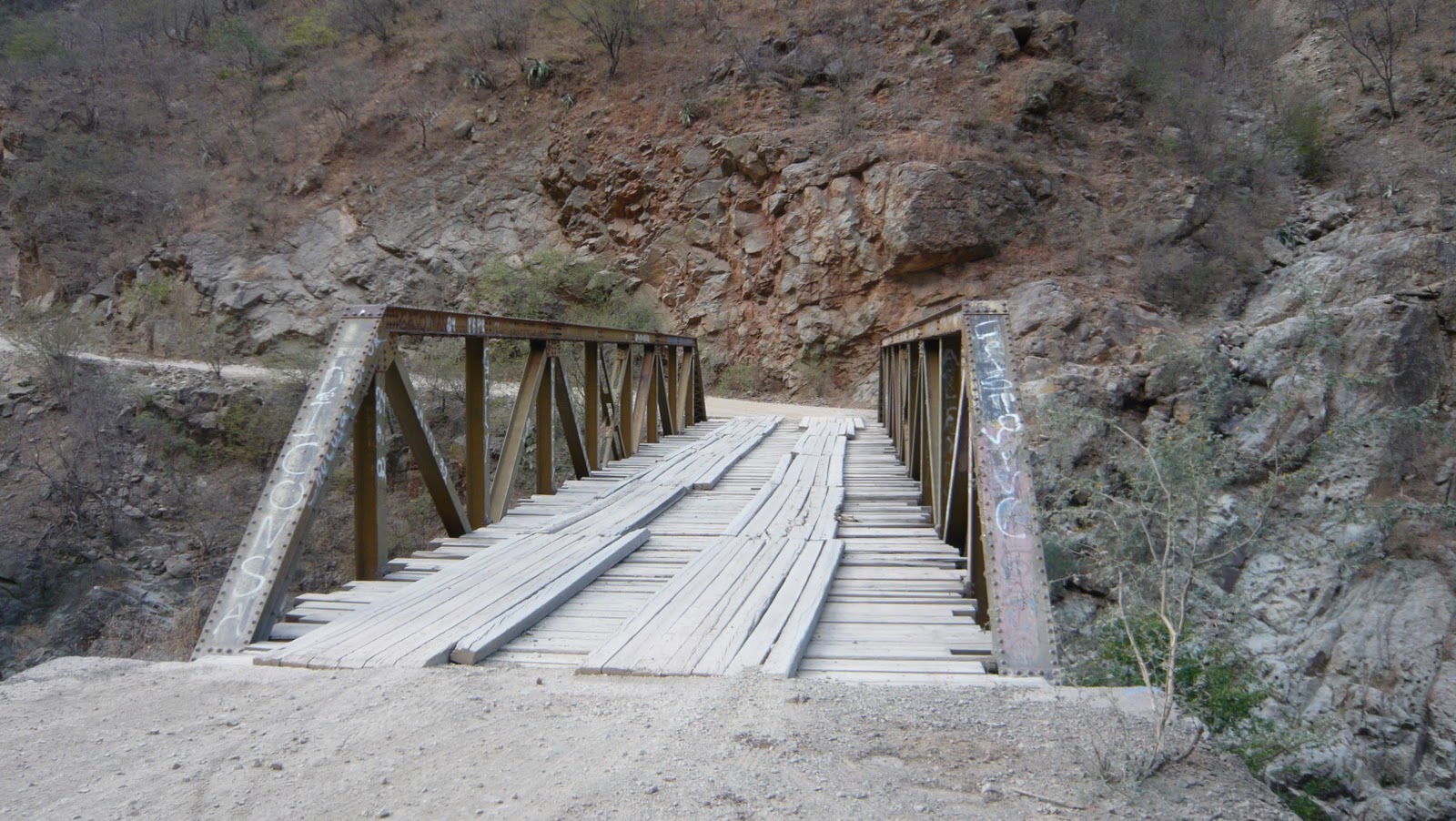
I thought that when we got to the first bridge that we had made it, but was I wrong, we had to go up and down the other side, and herd some cattle before we finally got to the bridge to Batopilas.

First Bridge to Cross

01 January 2011

The Valleys of the Frogs, Mushrooms & Erect Penises

On the road out of Creel to Batopilas we came across Valle de las Ranas (Valley of the Frogs), Valle de los Hongos (Valley of the Mushrooms) and, supposedly further away Valle de los Monjes (called Valley of the Monks or, in by the indigenous Tarahumara the Valley of the Erect Penises).  What these consist of is rock formations that have eroded over time to look like frogs, mushrooms and erections (to some).  The story is that the locals changed the latter to the Valley of the Monks to be more appealing to the tourist trade.  We don't think we ever got deep enough into the valley to see the latter but did get some good pics of the former:


Another tourist dad asked Curtis if he could get a picture of his son on Curtis' bike:

And there was the abandoned San Ignacio Mission in this valley as well:


But, we were wasting daylight and still had a long trek down to Batopilas in the Canyon so it was time to go.

A Cold Morning in Creel & Divisadero

After arriving in Creel we elected to stay in the Parador de la Montana a nice little motel with off-street secure parking, however we had no water pressure and kept making the mistake of locking ourselves out of the room.  The former was an inconvenience, and the latter not a big deal in the early evening, however, when I did it at 0600 the next morning in sub-freezing temperatures, and when Curtis was only wearing his long-johns it can be a very big deal.  Luckily the night attendant was able to secure a master key (after 2 tries) and save our asses.  There were a group of German students also visiting Creel and staying at the Parador at the same time -- probably for the hiking.  Here's a picture of the interior parking area early the next morning:

 And when I say it was cold, it was freezing (for those who cannot tell otherwise, that's frost on the fairing):

The hotel also had a great fireplace (which was most welcome when we got in the night before) that had a fantastic painting of the nearby Basaseachic Falls, the second highest waterfall in Mexico:

Before heading to Batopilas and into the Copper Canyon we elected to go to Divisadero at the top of the canyon.  It was a beautiful ride up there, and the views were stunning:

When we got up there the indigenous people were just setting up their goods for the tourists.  What was most interesting was seeing these people that, relative to us, really have nothing, but here were their children, in particular a little boy wearing bright blue pants and a jacket (likely made by hand by his mother) running around playing with the rocks and birds that were dancing around, as happy as can be.  It just goes to show, if you have the simple things in life: shelter, clothing, food, the love of your family, you have everything you need for true happiness.

Luckily for Curtis and I, Hotel Divisadero was up there (you can see it off to the right in the second panoramic shot), and they were still serving breakfast.  It had this huge stunning hand carved front door (the first picture is the unpainted inside, the second, the colored outside), and it has no locks because this hotel is always open:


We decided to video the ride back from Divisadero to Creel and if you look closely you can see some of the indigenous people by the roadside and tracks waiting for the trains and buses, and you get an idea of how beautiful of a day it truly was (or at least began):